
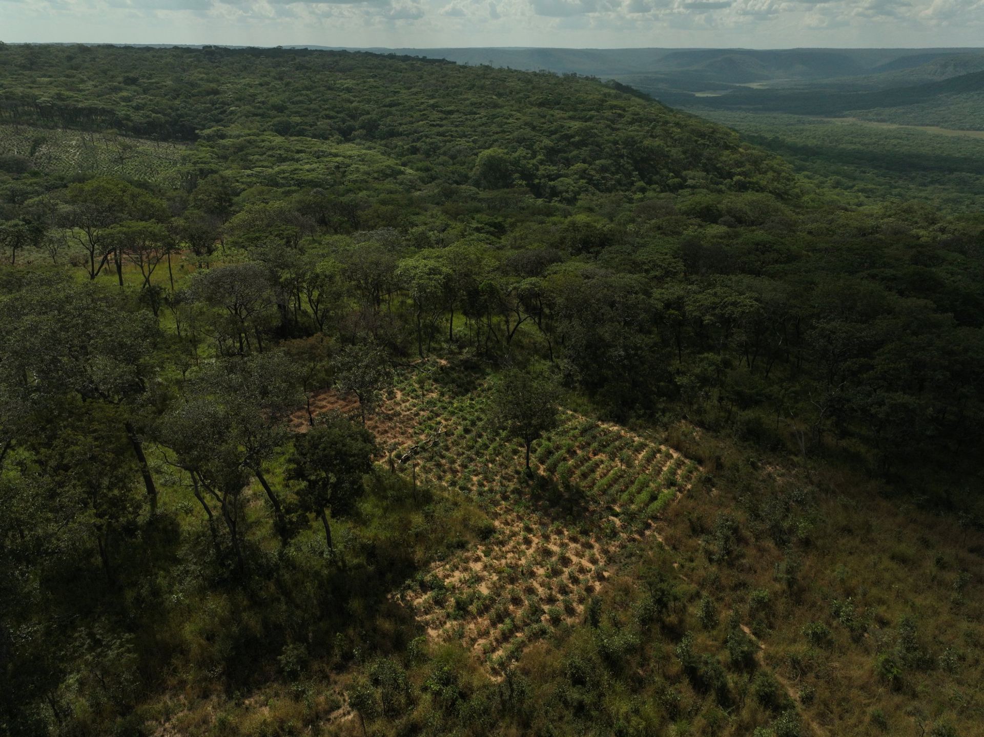
A smallholder farm can be too small for a global biomass map to represent accurately, and its youngest trees can be too small to register clearly in satellite imagery. For agroforestry and restoration projects, this creates a fundamental challenge: how do you estimate biomass when the data may not fully capture what is growing on the ground?
Between March and September 2026, RAMO interviewed 100+ practitioners working across Africa, Latin America and Europe. Across these conversations, a recurring challenge emerged among those working with smallholder farmers: global biomass datasets can struggle to represent the conditions on their plots.
The plots are small, often irregular in shape, and frequently contain recently planted trees. These characteristics create three distinct challenges for remote sensing-based biomass estimation: spatial resolution, the visibility of young trees, and the ability of models to represent the landscape being assessed.
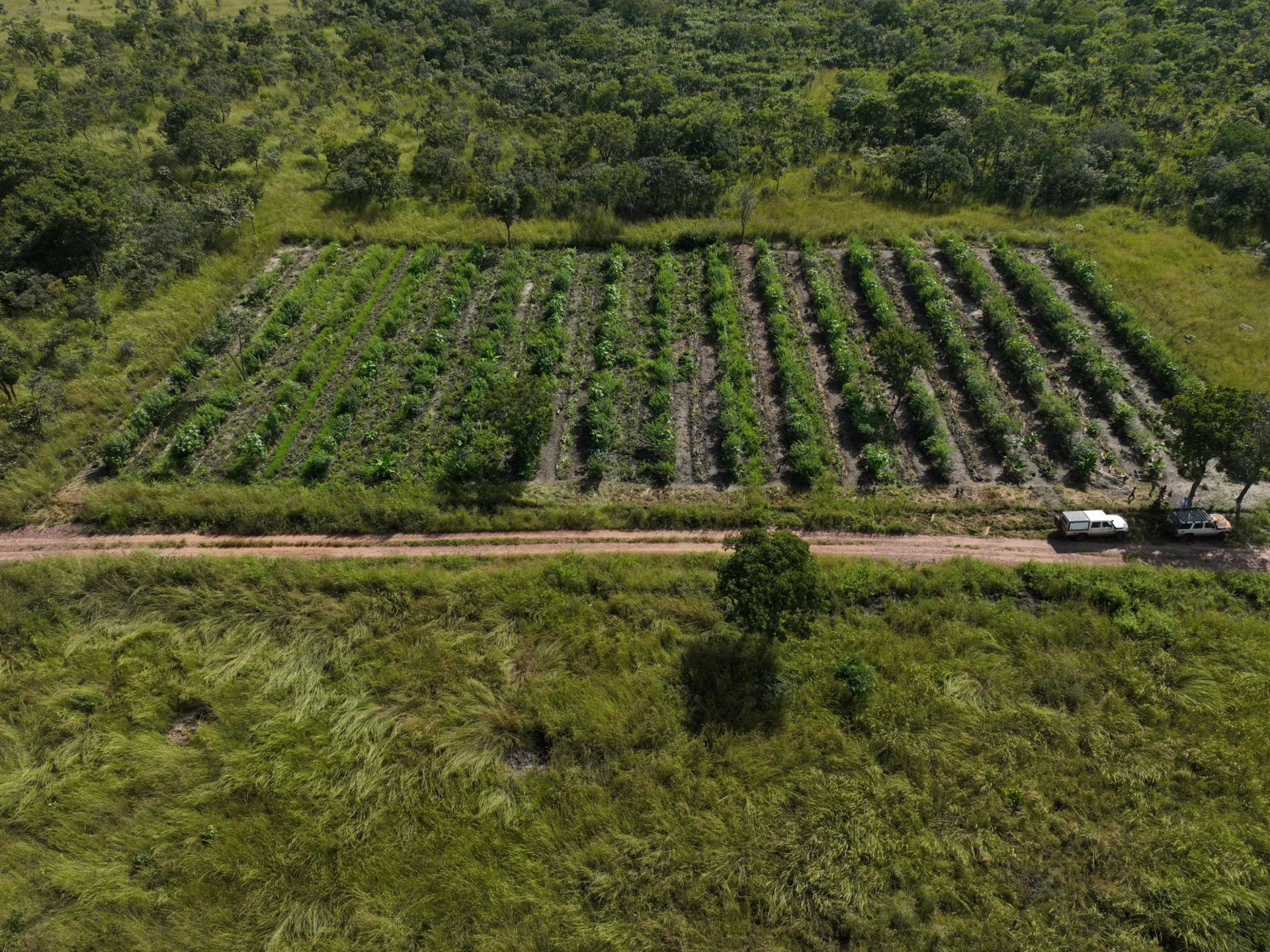
Consider a smallholder plot of 0.5 hectares.
ESA CCI Biomass provides above-ground biomass maps at 100 m resolution. Landsat imagery has a spatial resolution of 30 m, while Sentinel-2 provides imagery at 10 m resolution.
The difference becomes clearer when we compare the area represented by each pixel:
These are area-based comparisons, not guarantees about how many pixels fall entirely within a plot. The actual number depends on plot shape, boundary alignment and the spatial distribution of pixels.
For small, irregular plots, boundary pixels may include a mixture of the target plot and neighbouring land. This makes it harder to isolate the signal associated with the plot itself.
At 10 m resolution, a 0.5 ha plot spans approximately 50 pixels by area. But pixel count alone does not determine whether a plot-level estimate is reliable. Plot geometry, mixed pixels, vegetation structure and model performance all matter. For small plots, even finer-resolution data may need to be combined with field measurements and appropriate calibration.
Higher spatial resolution can help distinguish smaller areas, but it does not automatically produce more accurate biomass estimates.
Spatial resolution is only part of the problem. What a sensor can detect also depends on what is growing on the ground.
In newly planted agroforestry or restoration plots, individual tree crowns may occupy only a small fraction of a 10 m pixel. The recorded signal can therefore be dominated by inter-row vegetation, exposed soil or other land cover rather than the young trees themselves.
This is particularly relevant when monitoring early-stage projects. A planting programme may be progressing on the ground without producing a strong, distinguishable canopy signal in the available imagery.
Spaceborne lidar introduces a different constraint. Instruments such as NASA's GEDI collect measurements over discrete footprints along orbital tracks, rather than continuously measuring every plot. These observations can provide valuable information about canopy structure, but their sampling pattern does not guarantee coverage of every smallholder plot.
Canopy height estimates also tend to be more challenging in short vegetation, where relative errors can be high.
One practitioner raised the difficulty of estimating biomass in young tree plantings. The underlying question is not simply whether remote sensing can detect vegetation. It is whether the available measurements can distinguish the trees of interest from the surrounding landscape with enough reliability for the intended use.
For early-stage plantings, that distinction can be critical.
Remote sensing models depend on reference data. These can include field measurements, airborne surveys and other observations used to develop, calibrate or evaluate model estimates.
A model's performance depends partly on how well its reference data represent the conditions where it will be applied. Landscapes such as regrowth, degraded woodland and agroforestry mosaics may be poorly represented in some datasets, creating challenges when models are applied beyond the conditions covered by their training data.
One practitioner working in Zambia identified the availability of training data for regrowth and degraded Miombo woodland as a major challenge.
This matters because a model applied to a landscape that differs substantially from its reference data may be extrapolating beyond the conditions it has learned to represent. The result can be greater uncertainty or weaker performance, although the extent of that risk depends on the model and the landscape.
The implication is not that global models are inherently unsuitable. They can be useful for broad-scale screening and analysis. The question is whether their data, spatial resolution and performance are appropriate for the specific claim a project needs to make.
A model that performs well across a large region may still require additional calibration and evaluation before it can support reliable estimates for small plots or less-represented vegetation types.
These technical constraints matter because carbon methodologies and regulatory frameworks define how monitoring evidence is used.
Under Verra's VM0047 methodology, the requirements depend on the selected approach. The area-based approach uses remote sensing to assess project performance against a dynamic performance benchmark, supported by matched control plots. The census-based approach is designed for eligible projects where individual plantings can be inventoried. These approaches have different requirements and should not be treated as interchangeable.
The EU Carbon Removals and Carbon Farming Certification Framework (CRCF) also sets requirements for remote sensing models used to estimate living biomass under the relevant methodology. These include a minimum spatial resolution of 10 m for land cover and above-ground biomass, alongside local calibration using measurements that contribute to the final calculation of confidence intervals.
These requirements establish important conditions for monitoring, but they do not mean that a 10 m dataset automatically provides reliable estimates for every plot. Resolution, calibration, sampling design and uncertainty remain relevant to how results can be interpreted.
For programmes involving thousands of smallholder plots, measuring every plot individually can become prohibitively expensive. Remote sensing can help extend monitoring across the portfolio, but its role and the amount of field sampling required depend on the project's design and applicable methodology.
The practical challenge is to establish what the available data can support, where field measurements are needed, and how uncertainty should be represented in the final estimates.
Several questions remain important for practitioners developing smallholder agroforestry and restoration programmes.
How much field sampling is enough?
The answer depends on plot variability, vegetation type, model performance and the intended use of the estimate. Sampling needs to be designed to capture the conditions across the portfolio, rather than selected on the basis of convenience alone.
What does local calibration mean for geographically dispersed projects?
Projects spanning different ecological conditions may need to account for differences in vegetation, soils, climate and management. The appropriate calibration strategy depends on the applicable methodology and the extent to which the model represents those conditions.
How should uncertainty be reported for young plantings?
Early-stage vegetation can be difficult to distinguish from surrounding land cover. Monitoring approaches need to communicate the limits of the available evidence, rather than presenting estimates with a level of certainty the data cannot support.
These questions call for clearer practical guidance and greater transparency around calibration data, sampling design, model performance and uncertainty. Published results that explain where a model performs well, where it struggles and how it was calibrated would help project developers make better-informed decisions.
These decisions need to be considered at project origination, not only at the first verification.
Global biomass products can provide a useful starting point. But before choosing a monitoring approach, project developers need to understand what the available data can resolve, how well the model represents the landscape, and what additional measurements may be required.
We are continuously developing and refining our biomass datasets to improve coverage and representation across landscapes worldwide. Our current work includes custom above-ground biomass models for 11 countries: Angola, Brazil, Cameroon, Indonesia, Madagascar, Malawi, Mozambique, Portugal, Tanzania, Zambia and Zimbabwe. Our above-ground biomass model for Angola operates at 10 m spatial resolution, and we also develop canopy height models for Brazil, Malawi and Angola.

These country-specific models are part of a broader, ongoing effort to expand and improve our global geospatial data infrastructure, while accounting for the ecological conditions of the landscapes being assessed.
National or regional models can help address the challenge of representing the landscape being assessed. They do not, however, eliminate the constraints associated with small plots or young tree crowns. Nor does a higher-resolution model, on its own, establish that an estimate is reliable at plot level.
For project developers, three questions should be considered together:
These are complementary considerations. Increasing resolution cannot compensate for inadequate reference data, and a well-designed field sample cannot eliminate every limitation imposed by the available imagery. The monitoring approach needs to be evaluated as a whole.
Our view is that field calibration specific to the project remains central to credible biomass estimation. Sampling design and spatial resolution should be considered together, with uncertainty reported transparently rather than hidden behind a single estimate.
Global products remain valuable for landscape- and national-scale questions. Plot-level claims, particularly for smallholder projects and young plantings, require a closer assessment of what the underlying data can actually support.
For teams developing these projects, the objective is not to find one dataset that solves every problem. It is to understand the limits of the available evidence early enough to design a monitoring approach that is proportionate, defensible and practical.
NatureOS, RAMO's operating system for nature-based projects, helps project teams bring geospatial data into early-stage project assessment and planning.
Explore NatureOS to examine the landscape data available for your project and understand how they can inform the next steps in its development.
https://platform.ramo.earth/auth/sign-in
1. RAMO discovery interviews: Practitioner interviews conducted between March and September 2026. Observations are anonymised. Internal RAMO research.
2. ESA Climate Change Initiative (CCI) Biomass: Global above-ground biomass products and spatial resolution information.
3. NASA GEDI: Information on LiDAR measurements, footprint sampling and vegetation structure.
4. Verra VM0047: Afforestation, Reforestation and Revegetation methodology, version 1.1.
5. EU Carbon Removals and Carbon Farming Certification Framework (CRCF): Relevant regulatory requirements for remote sensing-based biomass estimation.
6. RAMO analysis: Pixel-area calculations based on nominal spatial resolution. These are illustrative comparisons, not measurements of plot-level accuracy or counts of fully contained pixels. Internal RAMO analysis.


